City on a Marsh
May 15, 2012 11:41 AM Subscribe
Many visitors to Boston assume that the Back Bay neighborhood is one of the city's oldest. It's actually one of the newest, reclaimed from Charles River marshland at the end of the 19th Century. Before the completion of this project, Beacon Street to Brookline was the top of a tidal dam. Today's Boston Proper is actually mostly fill: in 1630, Boston was 783 acres of land. By 1901, it was 1,904 acres. Filling in Back Bay was an enormous project, but some valuable lessons were learned decades earlier while filling in the South End.
There are lots of great Back Bay maps in the collection at the Norman B. Leventhal Map Center at the BPL, and Nancy Seasholes's Gaining Ground and Karl Haglund's Inventing the Charles give some more background on the history of landmaking in Boston.
posted by nonane at 11:51 AM on May 15, 2012 [2 favorites]
posted by nonane at 11:51 AM on May 15, 2012 [2 favorites]
No. It will sink much earlier than that, when the rot that's on the Back Bay's wooden pilings finally disintegrates them.
posted by ocschwar at 11:51 AM on May 15, 2012 [2 favorites]
posted by ocschwar at 11:51 AM on May 15, 2012 [2 favorites]
This is great post, Mayor Curley, thanks. Sorry about the comment - it's just something I would worry about if I was thinking about buying a house on fill.
posted by longdaysjourney at 11:51 AM on May 15, 2012
posted by longdaysjourney at 11:51 AM on May 15, 2012
"You know," he said, "there are things that won’t do for Newbury Street -- things that are out of place here, and that can’t be conceived here, anyhow. It’s my business to catch the overtones of the soul, and you won’t find those in a parvenu set of artificial streets on made land. Back Bay isn’t Boston -- it isn’t anything yet, because it’s had no time to pick up memories and attract local spirits. If there are any ghosts here, they’re the tame ghosts of a salt marsh and a shallow cove; and I want human ghosts -- the ghosts of beings highly organised enough to have looked on hell and known the meaning of what they saw."-- H. P. Lovecraft, Pickman's Model
posted by Harvey Kilobit at 11:52 AM on May 15, 2012 [7 favorites]
I love this kind of stuff. I love being able to see what things looked like before. Plus there are MAPS. HOORAY FOR MAPS.
posted by jillithd at 11:58 AM on May 15, 2012 [1 favorite]
posted by jillithd at 11:58 AM on May 15, 2012 [1 favorite]
You can blow peoples' minds by pointing out that the cross streets in the Back Bay proceed in alphabetical order: Arlington, Berkeley, Clarendon, Dartmouth, Exeter, etc.
No. It will sink much earlier than that, when the rot that's on the Back Bay's wooden pilings finally disintegrates them.
I went to elementary school in the Back Bay, and our outside play area had to be closed for a year so they could replace rotting pilings, and this was back in the 80s. We had recess and Gym in the Public Gardens and the Common for the year.
posted by Rock Steady at 11:59 AM on May 15, 2012 [1 favorite]
Also, if you like Boston and/or maps, you cannot do much better than to check out Mapping Boston by Alex Krieger and David Cobb.
posted by Rock Steady at 12:00 PM on May 15, 2012 [1 favorite]
posted by Rock Steady at 12:00 PM on May 15, 2012 [1 favorite]
longdaysjourney, if a significant earthquake hits Boston, I'd be a lot more concerned that pretty much everything in that neighborhood is made of brick.
posted by maryr at 12:01 PM on May 15, 2012
posted by maryr at 12:01 PM on May 15, 2012
Regarding the sinking and rotting wood ...
The city adopted the Groundwater Conservation Overlay District "to protect wood pile foundations of buildings from being damaged by lowered groundwater levels."
Buildings on the Flat of Beacon Hill are particularly susceptible to damage.
posted by ericb at 12:07 PM on May 15, 2012
The city adopted the Groundwater Conservation Overlay District "to protect wood pile foundations of buildings from being damaged by lowered groundwater levels."
Buildings on the Flat of Beacon Hill are particularly susceptible to damage.
posted by ericb at 12:07 PM on May 15, 2012
Isn't this all going to liquify and sink into the Bay when the East Coast has it's Big One?
Boston's Earthquake Problem -- "It's not the likelihood of a major earthquake that makes experts tremble -- though it's worse than you think. It's the damage one would do -- because it's MUCH worse than you think."
posted by ericb at 12:26 PM on May 15, 2012 [1 favorite]
Boston's Earthquake Problem -- "It's not the likelihood of a major earthquake that makes experts tremble -- though it's worse than you think. It's the damage one would do -- because it's MUCH worse than you think."
posted by ericb at 12:26 PM on May 15, 2012 [1 favorite]
> Also: etc only goes to H.
Ah, one of my favorite pieces of trivia. If you cross Mass Ave and head to Fenway you will find Ipswich, Jersey, and Kilmarnock streets. And the cross streets are Peterborough and Queensberry. I don't know where L, M, N, and O went.
> Isn't this all going to liquefy and sink into the Bay when the East Coast has it's Big One?
I moved to Boston after growing up in California, and after a few months enjoying the brick brownstones I did have a sudden panic of "What's going to happen to these in the next earthquake?". Of course, the first time I saw the green hills of Vermont I thought to myself "Who waters these?". Honestly.
> No. It will sink much earlier than that, when the rot that's on the Back Bay's wooden pilings finally disintegrates them.
I've heard that so long as they stay submerged wooden pilings do not rot. Something to do with the rot-causing bacteria needing oxygen. But if the water level drops and exposes the wood to air they start to rot quickly. So there's a lot of hydroengineers making sure the water table stays high.
posted by benito.strauss at 12:32 PM on May 15, 2012 [2 favorites]
THE FILLING OF MARSHES and shallow waters helped Boston prosper. "It's hard to conceive of Boston and, in fact, almost any big city in the United States, without the process of land making," says Nancy Seasholes, a research fellow at Boston University and author of Gaining Ground: A History of Landmaking in Boston. However, land making is a fundamental reason why many of Boston's buildings are not as stable as they look. The stately row houses that line Tremont Street in the South End, Charles Street at the foot of Beacon Hill, and Commonwealth Avenue in Back Bay are anchored by wooden pilings driven into the soil like candles into a moist birthday cake.posted by ericb at 12:32 PM on May 15, 2012 [1 favorite]
And the cake is getting stale.
Paul Finnegan awoke in his Beacon Hill bedroom on December 18, 1986, to a crash of brick and mortar next door. "It was the middle of the night," he recalls. "My head was right against the adjoining wall, and I heard this massive crash. I bolted upright to see if it was an earthquake." It was no earthquake but his neighbors' home buckling above its rotted foundation piles. "They were locked inside. They couldn't get their doors and windows open. It was a real mess." The level of water in the soil had fallen, and the wooden pilings, exposed to air, had rotted and failed, causing the building to settle nearly half a foot. (Most pilings in that area reach about 30 feet into the ground.)
With Boston's complex history of construction, large volumes of water have either leaked or been pumped out of the ground. Yet this ground water is crucial in preventing dry rot and insect infestation of the wooden pilings that hold up many of the city's older buildings. The falling water table has left the foundations of many of Boston's historic buildings compromised and susceptible to earthquakes and other disturbances.
These landfill problems -- amplification, liquefaction, and dry rot -- are compounded by the fact that Boston's grand old stock of wood-frame row houses, red-brick Victorians, and other unreinforced masonry buildings are, by almost every measure, structurally defenseless against the ground movement experienced in a large earthquake. Old buildings in Boston's suburbs face less risk, since fewer are built on landfill.*
Thanks for the link, ericb! And apologies for being earthquake obsessed. Last year was my first earthquake and I was in a DC high rise which ended up vibrating like my phone does when it's on "silent". So I'm thinking more earthquakes and how amazingly unprepared we are on the East Coast if we were to get something in the 6 or 7 magnitude range. At least California has some rules about building construction. I have no idea if the buildings I live and work in would be able to survive a 6-7 magnitude quake. (I like to think the high rise will, although it's built over a WMATA station, but my apartment? Pretty sure that's coming down.)
posted by longdaysjourney at 12:41 PM on May 15, 2012
posted by longdaysjourney at 12:41 PM on May 15, 2012
That should be "thinking about earthquakes".
posted by longdaysjourney at 12:42 PM on May 15, 2012
posted by longdaysjourney at 12:42 PM on May 15, 2012
You can blow peoples' minds by pointing out that the cross streets in the Back Bay proceed in alphabetical order: Arlington, Berkeley, Clarendon, Dartmouth, Exeter, etc.
In addition to the Back Bay street names being alphabetical they "are also alternately trisyllabic and dissyllabic."*
Ah, one of my favorite pieces of trivia. If you cross Mass Ave and head to Fenway you will find Ipswich, Jersey, and Kilmarnock streets. And the cross streets are Peterborough and Queensberry. I don't know where L, M, N, and O went.
"[T]here's another set [of alphabetical street names] off St. Botolph Street, running eastward: Albemarle, Blackwood, Cumberland, Durham, ..., Follen, Garrison, Harcourt, Irvington (swallowed up by Copley Place)."*
posted by ericb at 12:50 PM on May 15, 2012 [5 favorites]
In addition to the Back Bay street names being alphabetical they "are also alternately trisyllabic and dissyllabic."*
Ah, one of my favorite pieces of trivia. If you cross Mass Ave and head to Fenway you will find Ipswich, Jersey, and Kilmarnock streets. And the cross streets are Peterborough and Queensberry. I don't know where L, M, N, and O went.
"West Fenway features streets named after Scottish cities and towns present in Robert Burns' literary works: Peterborough, Kilmarnock, Queensbury. This was a result of influence by the Robert Burns Society influencing the city of Boston when a decision was made to simplify the original neighborhood plan by Frederick Law Olmsted's office. As originally planned in 1894, the street naming system was to continue the system originating in the Back Bay of naming streets in alphabetical order. Where the Back Bay proper ends at Hereford Street, the Fenway was to continue Ipswich, Jersey, Kenyon (Kilmarnock), Lansdowne, Mornington, Nottingham, Onslow, Peterborough, Queensbury, Roseberry, Salisbury, Thurlow, Uxbridge, Vivian, Westmeath (Wellesley), X omitted, York, and Zetland."*"For a really thorough discussion of the alpha streets, with lots of good links to historical maps, head here."*
"[T]here's another set [of alphabetical street names] off St. Botolph Street, running eastward: Albemarle, Blackwood, Cumberland, Durham, ..., Follen, Garrison, Harcourt, Irvington (swallowed up by Copley Place)."*
posted by ericb at 12:50 PM on May 15, 2012 [5 favorites]
Previous AskMe:"What are some city neighborhoods that follow an alphabetical-order street-naming convention like the north/south streets in Boston's Back Bay (from east to west: Arlington, Berkeley, Clarendon, etc.) or the east/west streets in San Francisco's Richmond and Sunset Districts (north to south: Anza, Balboa, Cabrillo, etc.)?"
posted by ericb at 12:52 PM on May 15, 2012
posted by ericb at 12:52 PM on May 15, 2012
Everyone had the same first thought as I did. Parts of Washington DC are fill as well, and when our "big one" hit last August I was in a building that was probably part of the Potomac 170 years ago.
Interesting experience.
posted by smoothvirus at 12:55 PM on May 15, 2012
Interesting experience.
posted by smoothvirus at 12:55 PM on May 15, 2012
L for Landsdowne street runs alongside Fenway Park, home of the Boston Red Sox. So what's so remarkable about alphabetically ordered streets? Boston has long been branded as having roads created by cows. Stephen Pulio has several chapters on the Back Bay in his his book A City so grand
posted by Gungho at 1:03 PM on May 15, 2012
posted by Gungho at 1:03 PM on May 15, 2012
What's so remarkable is just that - the presence of any order in the street names after a day here is shocking.
posted by maryr at 1:05 PM on May 15, 2012 [2 favorites]
posted by maryr at 1:05 PM on May 15, 2012 [2 favorites]
"Of course, many streets were named out of nostalgia for the settlers' original homeland or to honor famous personages in England. For example, all of the alphabetical cross streets in the Back Bay were named in honor of British lords, dukes, and earls: Arlington, Berkeley, Clarendon ..."*
That quote is from a book I highly recommend: What They Never Told You about Boston (Or, What They Did that Were Lies) by Walt Kelley.
BTW - Walt Kelley's personal history is fascinating:
That quote is from a book I highly recommend: What They Never Told You about Boston (Or, What They Did that Were Lies) by Walt Kelley.
BTW - Walt Kelley's personal history is fascinating:
"Boston born and raised, Walt Kelley graduated from the oldest high school in the United States - Boston Latin School - and then graduated from the oldest college - Harvard. He was employed by the oldest (naturally) bank in New England, The First National Bank of Boston; as executive vice president of MetroBank and Trust, and then joined First Security as vice president and controller. After thirteen years in finance, he changed fields and opened a family business which sold sports cards and sports memorabilia. Over the next six years he formed two more companies, one of which failed and caused the other companies to collapse. After the setback, he joined Town Taxi of Boston, where today he drives a cab - he won the 'Best Cab Driver in Boston Award in 1987. He and his wife, Linda, live in Boston". [from his biography page in the book].posted by ericb at 1:07 PM on May 15, 2012
Stephen Pulio has several chapters on the Back Bay in his book A City So Grand.
The filling in of the Back Bay features prominently in the plot of William Martin's historical novel/thriller Back Bay.
posted by ericb at 1:11 PM on May 15, 2012
The filling in of the Back Bay features prominently in the plot of William Martin's historical novel/thriller Back Bay.
posted by ericb at 1:11 PM on May 15, 2012
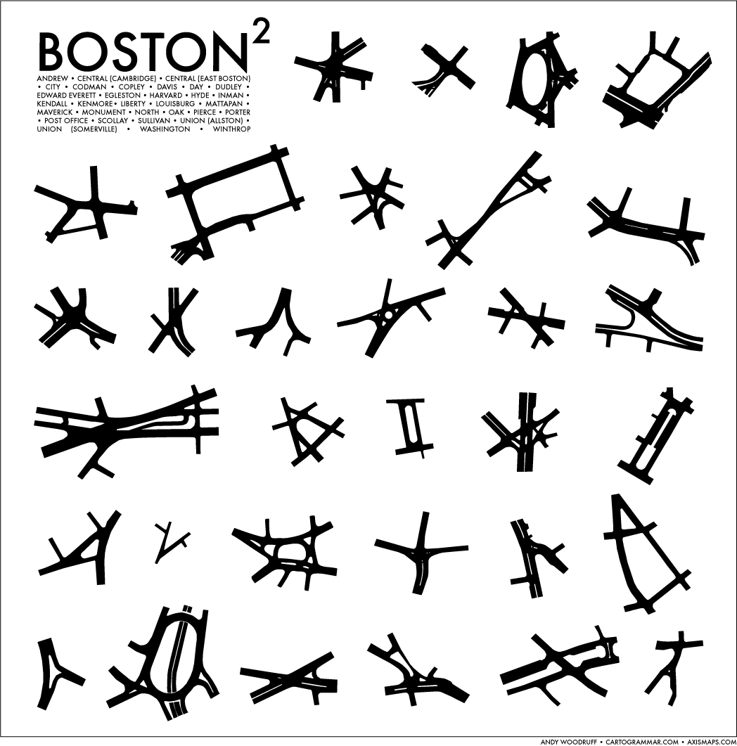
Some of Boston's major intersections.
...and MBTA world
posted by Reasonably Everything Happens at 1:39 PM on May 15, 2012 [6 favorites]
...and MBTA world
posted by Reasonably Everything Happens at 1:39 PM on May 15, 2012 [6 favorites]
Reasonably Everything Happens: "...and MBTA world"
Oh, that's great. Sorry, Mario! Your princess is on a different branch of the Green Line!
posted by Rock Steady at 1:43 PM on May 15, 2012
Oh, that's great. Sorry, Mario! Your princess is on a different branch of the Green Line!
posted by Rock Steady at 1:43 PM on May 15, 2012
...and MBTA world.
In related news: Advertisers May Get Shot At Renaming MBTA Stations.
posted by ericb at 1:46 PM on May 15, 2012
In related news: Advertisers May Get Shot At Renaming MBTA Stations.
posted by ericb at 1:46 PM on May 15, 2012
Of course, the downside of alphabetically ordered streets is that I no longer remember the full names of any streets, and have to give directions like "Go to the street that starts with 'F', then turn left."
posted by benito.strauss at 1:47 PM on May 15, 2012
posted by benito.strauss at 1:47 PM on May 15, 2012
> In related news: Advertisers May Get Shot At Renaming MBTA Stations.
Cool. What are they going name the stop at the Garden? I mean Fleet Center, er, no, TD Banknorth .....
posted by benito.strauss at 1:49 PM on May 15, 2012
Cool. What are they going name the stop at the Garden? I mean Fleet Center, er, no, TD Banknorth .....
posted by benito.strauss at 1:49 PM on May 15, 2012
ericb: "In related news: Advertisers May Get Shot At Renaming MBTA Stations."
Back when I lived in Boston 10+ years ago they tried this. I think they officially renamed the State Street stop "State Street/Citizens Bank" or something equally stupid.
posted by Rock Steady at 1:51 PM on May 15, 2012
Back when I lived in Boston 10+ years ago they tried this. I think they officially renamed the State Street stop "State Street/Citizens Bank" or something equally stupid.
posted by Rock Steady at 1:51 PM on May 15, 2012
Advertisers May Get Shot At Renaming MBTA Stations.
I think it's an empty threat the MBTA's making until they get some decent funding.
posted by Reasonably Everything Happens at 2:46 PM on May 15, 2012
I think it's an empty threat the MBTA's making until they get some decent funding.
posted by Reasonably Everything Happens at 2:46 PM on May 15, 2012
I think my favorite part of that SNES MBTA map is the happy giant forests of the Fellsway and the Blue Hills. Also that Logan seems to be some sort of abyss.
posted by maryr at 2:52 PM on May 15, 2012
posted by maryr at 2:52 PM on May 15, 2012
"filling in the South End" and "Filling in Back Bay", and no NSFW tag?
posted by Hoopo at 3:16 PM on May 15, 2012 [1 favorite]
posted by Hoopo at 3:16 PM on May 15, 2012 [1 favorite]
In addition to the Back Bay street names being alphabetical they "are also alternately trisyllabic and dissyllabic."
I'm sorry, "Gloucester" is disyllabic.
posted by madcaptenor at 6:16 PM on May 15, 2012
I'm sorry, "Gloucester" is disyllabic.
posted by madcaptenor at 6:16 PM on May 15, 2012
The last link mentions Bay Village, which I recently discovered after learning of a great sandwich place located there, Mike and Patty's, so it was interesting to learn that that neighborhood, old as it is, stands on top of landfill. (I learned of Mike and Patty's because the guy who runs Toscanini's (Gus) has a twitter feed (@tosci) which I follow, and he mentioned them.)
posted by A dead Quaker at 7:31 PM on May 15, 2012
posted by A dead Quaker at 7:31 PM on May 15, 2012
Filling in Back Bay was an enormous project...
...especially that time it was filled with molasses.
posted by XMLicious at 7:32 PM on May 15, 2012
Everyone knows the Molasses Flood happened in the North End!
posted by Mayor Curley at 8:11 PM on May 15, 2012 [2 favorites]
posted by Mayor Curley at 8:11 PM on May 15, 2012 [2 favorites]
I'm sorry, "Gloucester" is disyllabic.
And you could make a case that BERK-a-LEE street is trisyllabic.
posted by Mayor Curley at 8:16 PM on May 15, 2012
And you could make a case that BERK-a-LEE street is trisyllabic.
posted by Mayor Curley at 8:16 PM on May 15, 2012
smoothvirus: "Everyone had the same first thought as I did. Parts of Washington DC are fill as well, and when our "big one" hit last August I was in a building that was probably part of the Potomac 170 years ago. "
Actually, there are very few structures on the reclaimed parts of DC, and the Park Service have been gradually building some manmade hills around the filled portions to from a dam, because they're also worried about it sinking and flooding the rest of the city.
Basically, just about everything north of Constitution Ave and East of the Washington Monument is solid ground. The only major building on reclaimed land is the Lincoln Memorial (and I think part of the Kennedy Center). Constitution Ave used to be riverfront west of the White House, and a creek (later a canal) east of that. A few buildings (notably the Reagan Building and IRS) sit on wooden pilings above the former creek. The present Southwest Waterfront follows roughly the same shoreline, but used to border the Potomac instead of the inlet.
Really, the story about DC's reclaimed land is kind of boring. Seattle's story is much weirder than Boston or DC.
posted by schmod at 10:12 PM on May 15, 2012
And you could make a case that BERK-a-LEE street is trisyllabic.
There was a moment in my life when I lived in Cambridge and was considering going to grad school in Berkeley, California. I am not a musician, and many people were confused by my claim that i'd gotten into Berkeley because it sounded exactly like Berklee, the music school in the back bay.
posted by madcaptenor at 10:32 AM on May 16, 2012
It goes both ways, madcaptenor. I moved to Boston after being in grad school as UC Berkeley (Evans Hall represent!), and got tired of people who asked where I went to school then asking what my instrument was. My strategy of saying "BERK-ley, not ber-KLEE" was amazingly ineffective.
posted by benito.strauss at 11:04 AM on May 16, 2012
posted by benito.strauss at 11:04 AM on May 16, 2012
I found "Berkeley, in California" to work. Even if they hadn't heard of it, they knew that it wasn't Berklee. (Except for the cab driver I had once who took me to MIT and asked me what it stood for. I told him it stood for "Massachusetts Institute of Technology" and he asked me what Massachusetts was.)
posted by madcaptenor at 7:48 PM on May 16, 2012 [1 favorite]
posted by madcaptenor at 7:48 PM on May 16, 2012 [1 favorite]
« Older Get off my lawn, programming n00bs! | 75 mpg. Newer »
This thread has been archived and is closed to new comments
posted by longdaysjourney at 11:43 AM on May 15, 2012 [1 favorite]