Aerial Photos 1906 Great American Cities
May 8, 2018 5:11 PM Subscribe
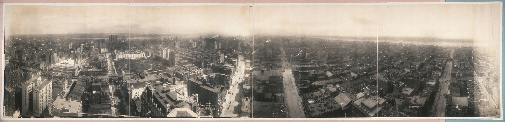
Link together a bunch of kites and hoist a camera up several hundred feet, and voila! There are several links in the article to different deposits of aerial photos by the enterprising George R. Lawrence.
Those photos are so neat - I hadn't thought of how they accomplished that sort of thing. Thanks for posting!
posted by needlegrrl at 8:06 AM on May 9, 2018
posted by needlegrrl at 8:06 AM on May 9, 2018
Great stuff! So is that Bryant Park bridging the first and second segments here? Manhattan in 1906 was a different world!
posted by languagehat at 8:52 AM on May 9, 2018
posted by languagehat at 8:52 AM on May 9, 2018
this is so dope.
posted by FiftyShadesOfBae at 3:50 PM on May 9, 2018
posted by FiftyShadesOfBae at 3:50 PM on May 9, 2018
« Older Not Actually Powered by Water | Old man yells at cloud Newer »
This thread has been archived and is closed to new comments
they have instructional materials online, including a website to help you match photos to locations
they have kits for sale
posted by eustatic at 5:49 PM on May 8, 2018 [1 favorite]